LandProf. Designing of pipeline on the plan
Laying of pipeline on the plan
Landprof2012 allows to lay underground and ground pipeline in the plan. Any general or enlarged topographic plans of any scale created in specialized systems (Credo, AutoCAD, Civil3D, etc.) or drawn in AutoCAD can be used as the basis. Dots or predrawn polilines are used to create the pipeline. Calculation of stationing is carried out completely automatically using available functions for handling cut pickets or retracing as well as full set of tools to comply with GOST 21.610-85. Our experience of cooperation with leading civil engineering companies allowed us to envisage solution scenarios for various situations which may arise in the process of designing, for example, displacement of the plan model from the route of gas pipeline, alteration of the direction of the route of gas pipeline and many others. The base of the design can be supplemented with new information at any stage of designing which allows to avoid loss of time for corrections.
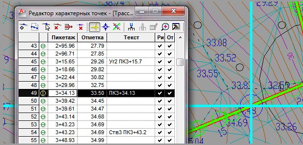
Determination of Marks
LandProf 2012 offers a rich and time-proved set of tools to handle the digital terrain model allowing to determine and specify actual or design marks along the gas pipeline route quickly.
Marks can be determined automatically or manually using digital models of terrain (DTM) created in CREDO, AutoCAD, Civil3D or any other specialized systems used by companies or subcontractors. If there is no DTM available, marks can be determined by blocks with marks drawn in the plan.
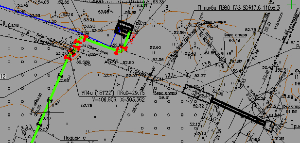
Intersections with actual situation objects (including existing communications)
LandProf2012 helps to design pipelines in developed areas by means of special tools to handle intersections with existing communications. One can determine the location of intersections manually or automatically. With the use of a specialized application TopoPlan 2012, all intersections and characteristics thereof can be determined automatically. LandProf 2012 allows to determine intersections with communications created in CREDO. Minimal distances between underground gas pipelines and underground constructions are stipulated (Application B CP 62.13330.2010). Intersection lists are generated automatically on the basis of templates.
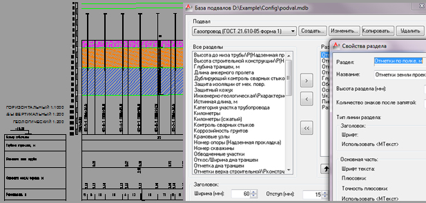
Preparation of initial set of drawings of pipeline profile
LandProf 2012 allows to generate instantly the drawing of any section of the pipeline in the set vertical and horizontal scales and with a selected basement table. The profile drawing is generated on the basis of predetermined marks and intersections with existing communications (determined beforehand).
LandProf2012 allows to carry out tuning of graphic AutoCAD primitives constituting the profile drawing in order to exclude any subsequent manual elaboration of the drawing.
In particular, during the tuning of the basement table you can specify the number and sequence of the sections and their location in the layers, specify a text style and select accuracy of rounding of numerical values for each section. The delivery set includes basement tables tuned for various profiles including works according to GOST 21.610-85.
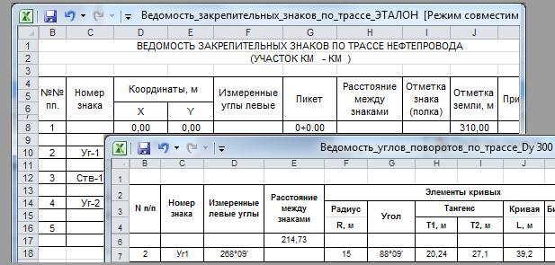
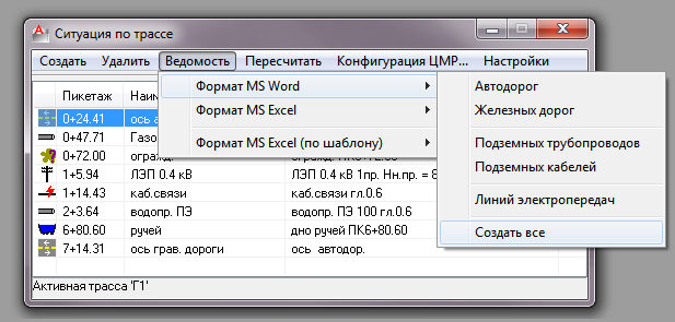
Reports
LandProf 2012 allows to generate 11 reports (lists) in MS Word, MS Excel and AutoCAD which will help to save tremendous amount of time, especially, in designs in developed areas or in cases of late stage alterations to the design. Lists are generated on the basis of edited templates. The lists include: list of turning angles, list of intersections with existing communications, list for creation of profile, list of sections with longitudinal slopes, list of hillside sections, land list, coordination/concordance list, etc.